Rock lifts.
An uplifted dome bends the layers into a broad arch.
LANDSCAPE KEY Uplift
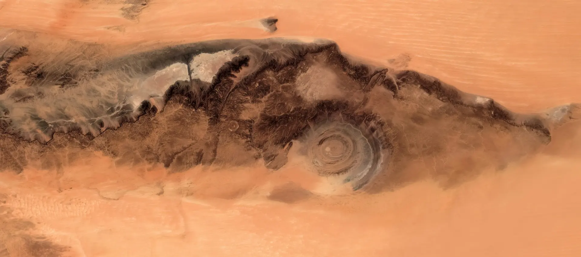
01 / The landscape
A circle of rock. A different way to see Earth.
Concentric ridges spread across a desert plateau. From space, the Richat Structure becomes a vast eye; on the ground, the same pattern is a succession of rock and valley.
One detail to remember
40
kilometres across · approximately
The structure is an eroded dome revealed in concentric ridges.
Source / USGS · Landsat view of the Richat Structure02 / Landscape anatomy
Three ways to read Richat Structure.
A field guide to what you’re seeing.
An uplifted dome bends the layers into a broad arch.
Unequal resistance leaves ridges and valleys in the worn dome.
Seen from above, those layers form a concentric pattern.
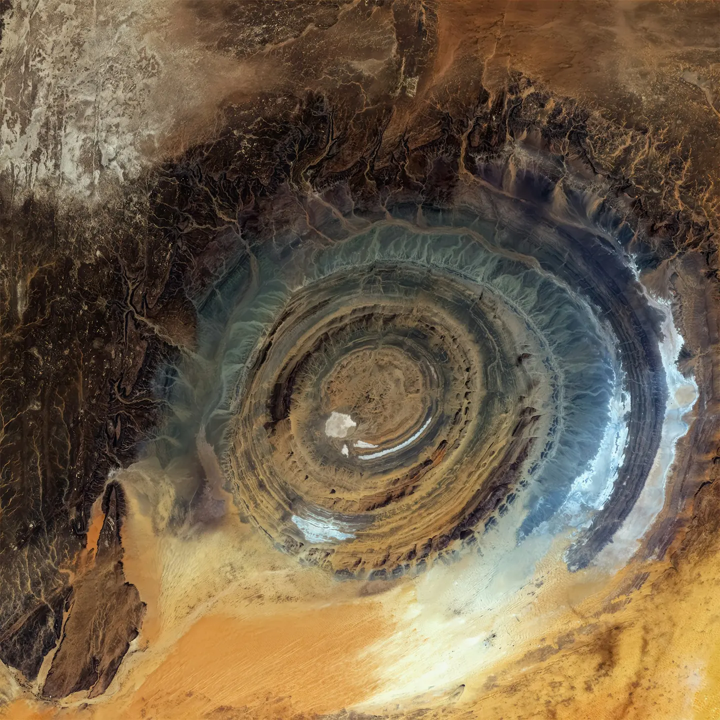
The rings are the record.
Erosion is the editor.
Behind the view
The rings mark the remains of an uplifted geological dome. Erosion removed material unevenly, leaving more resistant rock standing as ridges around the centre. USGS describes a mixture of sedimentary and volcanic rocks across a structure roughly 40 kilometres wide. Northeasterly winds help keep much of the exposed rock clear of sand. Its geometry once suggested an impact crater, but geological research instead points to uplift and erosion. The circle is a cross-section through a deeply worn landscape.
03 / The human story
Caravan country.
A landmark seen from orbit.
Long before photographs from orbit made the rings internationally recognisable, the surrounding Adrar Plateau held a human history of tools, rock art and caravan towns. NASA traces another chapter to the Gemini IV mission: astronauts Ed White and James McDivitt photographed the formation in 1965, helping bring it to wider attention. Their distant viewpoint revealed a pattern difficult to grasp while standing within it. The landscape gained a new audience when people learned to see it from above.
04 / Across time
The largest contrast is between geological time and mobile sand. Wind shapes the surrounding dune fields while the exposed ridges retain the outline of the eroded dome.
Erosion exposes the structure within the uplifted rock.
Wind shapes dune fields around the exposed ridges.
Rock ridges and surrounding sand record different kinds of movement. The exposed dome preserves a long history of deformation and erosion; nearby dunes take their forms from moving air. NASA’s astronaut imagery shows both longitudinal and transverse dune fields around the structure. A satellite photograph places these neighbouring patterns in the same frame, connecting a slowly revealed geological structure with the continuing movement of desert sand.
Keep looking / Sources & photography
Hero: USGS / Unsplash License · Resized and WebP compressed; cropped for display.
Second photograph: USGS · Michelle A. Bouchard / Unsplash License · Resized and WebP compressed; cropped for display.